Click here to sign up for our free daily newsletter.
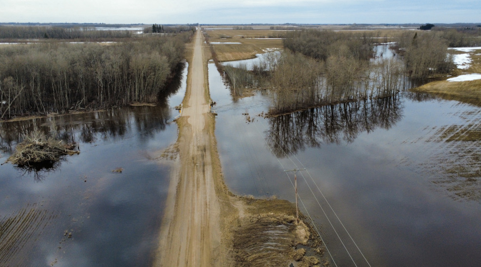
The road is saturated and crumbling from floodwater near the Garden River bridge. (Image Credit: Nigel Maxwell/ paNOW Staff)
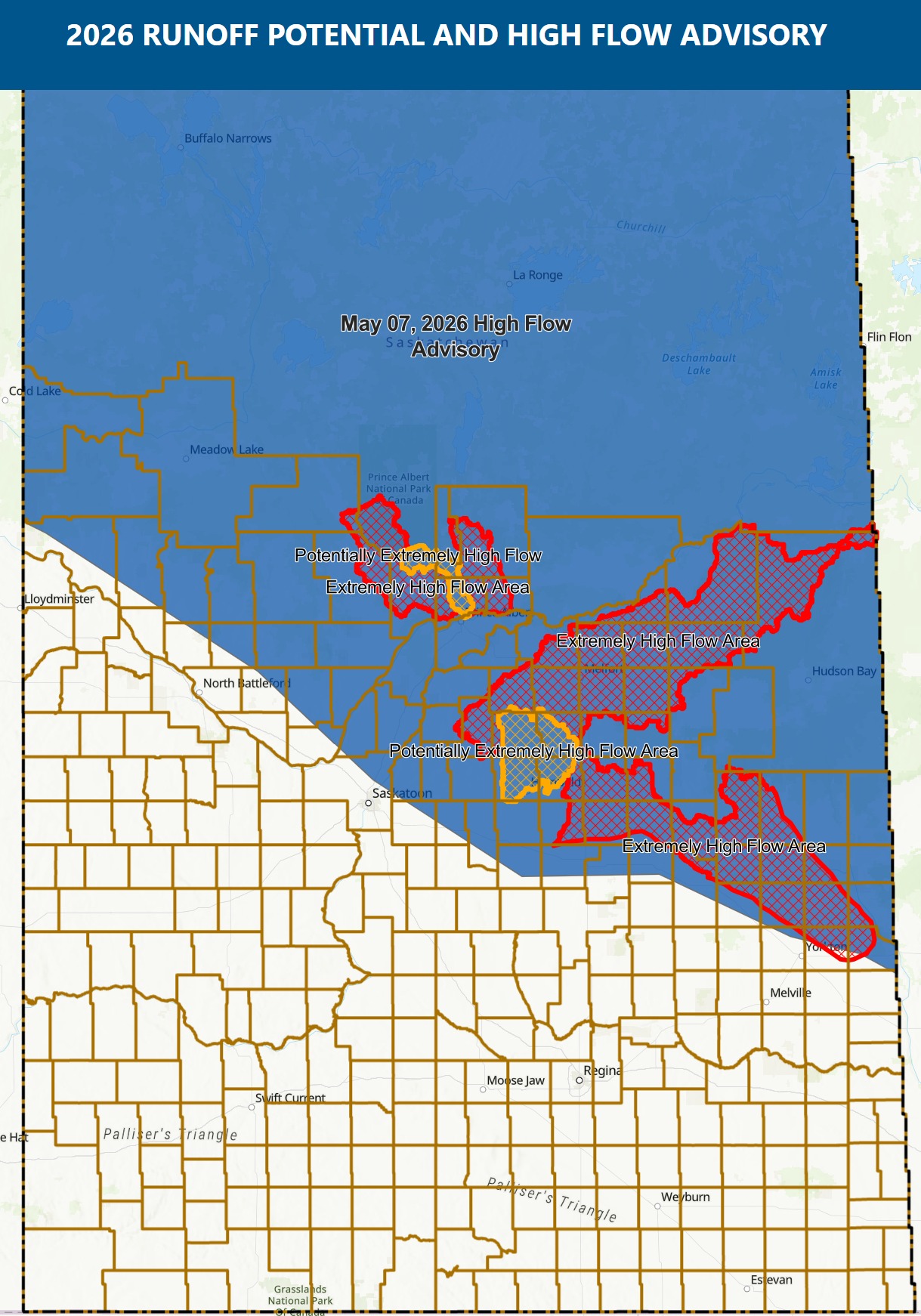
Flood zones

Water levels dropping, but flooding persists in RM of Paddockwood

May 7, 2026 | 1:41 PM

Along the narrow Paddockwood grid, there is water on both sides of the road where large farm fields would normally be.

The section of grid off Hanson Hill Road is one of many roads in the rural municipality that has been closed off to traffic due to rising floodwater. Local resident Curtis Braaten tells paNOW he has never seen anything like it.

As per the latest update from the RM of Paddockwood, there is currently no clear path from Highway 120 to Highway 2 through the rural municipality.

Over the next few days, if the water drops, crews will begin analyzing those areas to get temporary fixes in place. All bridges in the flood zones will require professional inspections to ensure they are structurally sound going forward. Towards Garden River bridge, Braaten noted the water level has dropped.

A view from above Paddockwood Road
A view from above Paddockwood Road (Image Credit: Nigel Maxwell/ paNOW Staff)

The RM is monitoring water levels and anticipates the water will move south through established water runs, creating potential increases in flow again in certain areas.

Thursday afternoon, the RM issued an advisory that Anglin Lake levels were critical and water could begin flowing over the dam.

If that happens, Bells Beach South (between the Northside grid and Highway 263) and the Northside Grid (west of the Hamlet of Northside) could be affected.

Like other RMs in the region, council has also requested designation under the Provincial Disaster Assistance Program (PDAP) for this spring flooding event.

Forms will be made available as soon as the RM’s designation is finalized.

In the meantime, residents are being encouraged to follow safety protocols and exercise extreme caution when driving, particularly in areas prone to flooding. Any instances of water over roads should be reported to the RM Office.

WSA map May 7, 2026.
WSA map May 7, 2026. (Image Credit: RM of Prince Albert No. 461/Facebook)

On Thursday afternoon, the Water Security Agency (WSA) reported that the Rural Municipality of Prince Albert No. 461 is now included in the Extremely High Flow Advisory area. Residents are urged to remain alert and be prepared to evacuate if necessary.

Just off Highway 2 and the Meath Park access road, Pat White sat in a lawn chair Thursday afternoon overlooking the flooded back portion of his yard. As he watched a crew working in the area, he explained he has been pumping water for five days.

 “My garden is under there, but you can’t see it,” he said.

A flooded property off highway 2 and Meath Park Access Road
Crews were on site containing the water.
Crews were on site containing the water. (Image Credit: Nigel Maxwell/ paNOW Staff)

According to the Water Security Agency, the Sturgeon, Spruce and Garden rivers north of Prince Albert are marking the highest flow rates in recorded history. Flows on all three have increased rapidly over the last three days as warmer temperatures continue to drive snow melt. 

nigel.maxwell@pattisonmedia.com

On X: @nigelmaxwell