Sign up for the paNOW newsletter

New weather forecasting technology due by February

Nov 16, 2017 | 11:07 AM

New weather forecasting technology that will offer quicker and more accurate data is coming to our region but it’s still three months away. And there were signs this week that the new system is much-needed.

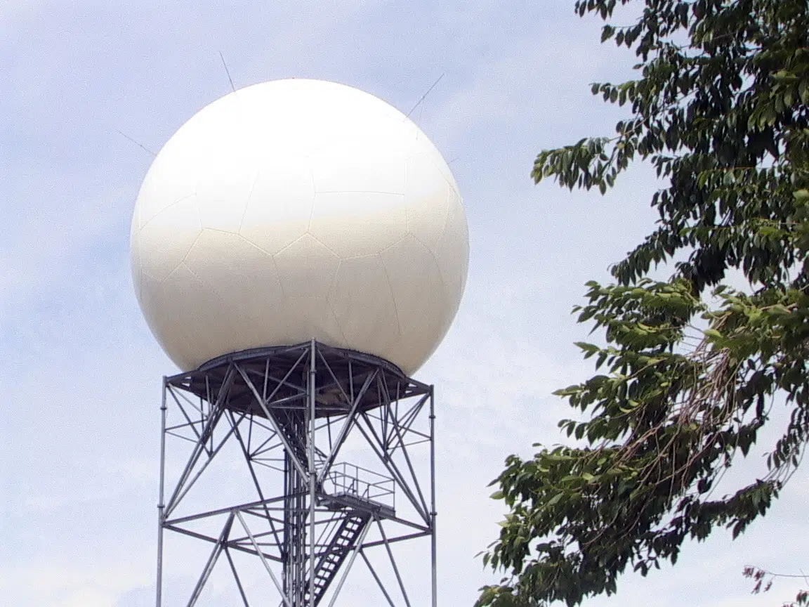
The first in a series of 20 confirmed new-generation dual polarization Doppler radars across the country is being commissioned in Radisson, the site of the original Doppler site rolled out 36 years ago. Thirteen more are also potentially in the pipeline.

 “It’s finishing its acceptance testing at the beginning of December,” Peter Leibiuk, the engineering authority which is overseeing the project, told paNOW. “It’ll be operating with an internal feed up until February when the forecasters will then get the official feed from the radar and shortly after the weather office will have public images.”

The Radisson station project is a complete replacement of the original, which carried the serial number ‘001’ for the then state-of-the art technology for Canada back in 1981. The latest radars will offer far more precise detection of various weather systems.

“The new weather radar is extremely sensitive compared to the system we’re replacing,” Leibiuk said. “ We can identify the different particles in the atmosphere, and distinguish rain drops from snow flakes and hail pellets and even freezing rain.”

The new technology will also analyze detailed movements in weather systems.

 “We’ll be able to see things like rotation in a thunder storm,” meteorologist John Paul Cragg said. “That will allow us to issue tornado warnings as well as detect different types of precipitation so it’s a lot better than what we had.”

Cragg said the new radar will scan every six minutes as opposed to the old ten minute schedule allowing for a quicker and better look at weather that’s developing. Summer storms especially evolve rapidly so forecasters will be able to offer the public a far clearer and quicker picture of what’s happening and what’s likely to happen.

But as we wait for the new Radisson radar to come online in February officials admit there are currently gaps in weather detection capability. It’s something that may have contributed to the surprise storm we had in our region earlier this week.

“We are using radars in the vicinity to help fills the gaps created by Radisson being down,” Craigg said. It’s not perfect but is has worked quite well and we do get a lot of information from that.”

Tuesday’s snow and freezing drizzle storm was not forecast catching many off guard, such as school bus operations.

Cragg said while specific precipitation like freezing rain is hard to detect because of the large distances between surface weather stations, the new system will make predicting such events easier.

“The new dual polarization will help us being able to forecast that more accurately.”


glenn.hicks@jpbg.ca

On Twitter: @princealbertnow