Click here to sign up for our free daily newsletter.
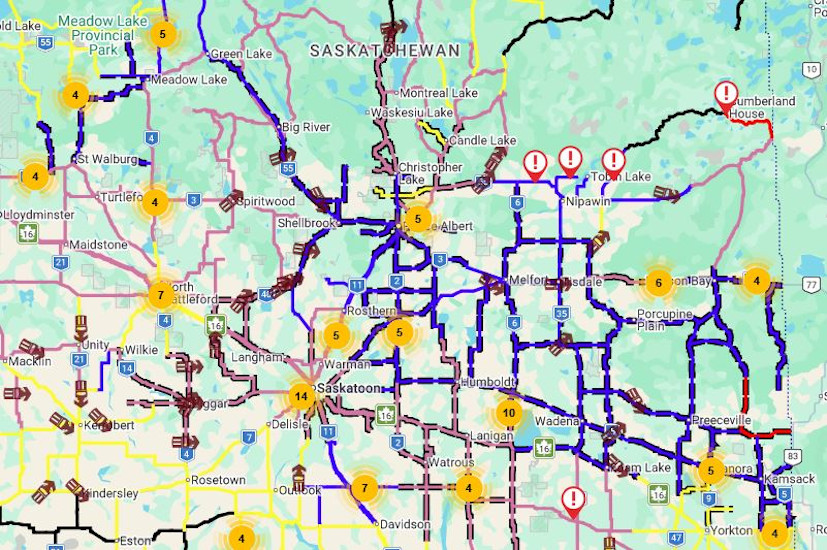
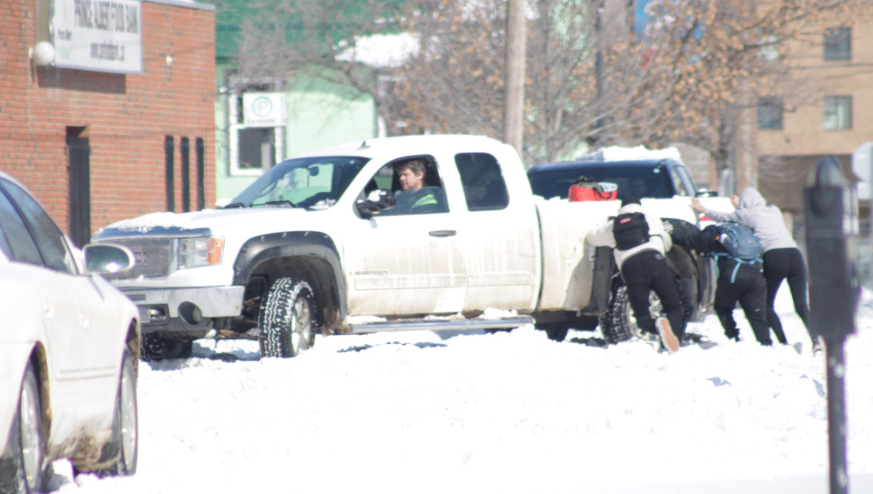
As a result of vehicles getting stuck, there was a long backlog of traffic at the junction of Highways 2 south and Highway 11. (Image Credit: Facebook)
Wild weather

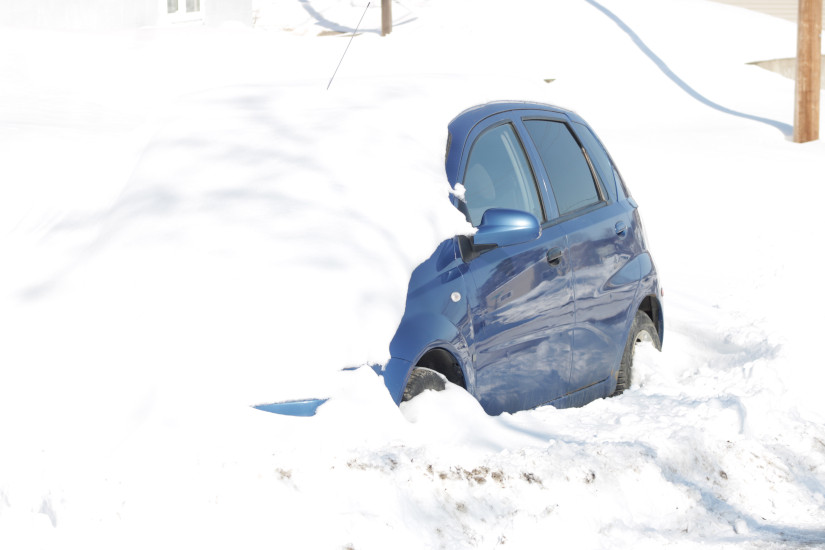
Spring snowstorm leaves drivers stranded

Apr 8, 2026 | 10:05 AM

Another massive spring snowstorm has left a large part of the province under a significant blanket of snow. 

The Alberta Clipper that tracked through central and northern Saskatchewan on Tuesday caused travel headaches, closed highways, and led to drifting, heavy, and wet snow. 

Danielle Desjardins is a Warning Preparedness Meteorologist with Environment and Climate Change Canada. She said that the heaviest band of snow fell on a line from Meadow Lake, north of Prince Albert, making its way east. 

Meadow Lake had roughly 37 cm of snow, or almost 15 inches, while the Prince Albert area reported roughly 20 cm. 

“All in all, it’s looking like the further north you head, it’s 20 centimetres plus, with Meadow Lake being the biggest accumulation we’ve seen so far,” Desjardins said. 

As of 2 p.m. the travel not recommended advisories for the Prince Albert area had been lifted, but highways remained partially covered. Highway Hotline was still not recommending travel for the Melfort and Tisdale areas.

From 3p.m. April 7 to noon April 8, Saskatchewan RCMP responded to 78 collisions all across the province. These include motor vehicle collisions, vehicles in the ditch, and other traffic hazards.

Saskatchewan RCMP said they were not aware of any serious injuries or fatalities related to these incidents.

Dan Palmer with the Ministry of Highways says a lot of snow falling in a short amount of time makes the job even harder for snow plows.

“There was lots of wind and this affected visibility. So, what was happening overnight as crews were trying to clear roads, is that they would clear roads but it would drift back in and then visibility became very difficult and challenging.”

The province’s graders are out, so conditions should continue to improve throughout the day. Palmer encourages drivers to check the Highway Hotline frequently.

“This is April. Weather can change quickly, and here we are with snow again,” Palmer said.

A look at provincial highways as of 10a.m. on Wednesday.
A look at provincial highways as of 10a.m. on Wednesday. (Image Credit: Highway Hotline)

In Prince Albert, snow removal operations are fully underway. The City’s Senior Operations Manager Tim Earing said safety routes are done, and crews are working on priority one routes, before moving on to the priority twos.

“We’re hoping we can be done by this Saturday,” he said.

Earing explained the snow clearing efforts were challenged by the fact there was so much snow and it was both wet and heavy. He added crews were out at 5a.m.

 “We can only have them work so many hours in a day but we like starting as early as we can so that we get ahead of the traffic.”

The duration and volume of snowfall have resulted in delays to transit, garbage, and recycling services.

Transit will not be running today however this might change later today as routes get cleared. For updates on service resumption, got to citypa.ca/news/transit-news/.

Due to heavy snow and anticipated melting conditions, today’s Zone 2 garbage pickup has been moved to Friday. Friday’s Zone 4 recycling pickup is cancelled to ensure crews can complete the Zone 2 route.


(Image Credit: Nigel Maxwell/ paNOW Staff)
Good samaritans assist a stranded driver.
Good samaritans assist a stranded driver. (Image Credit: Nigel Maxwell/ paNOW Staff)

There is some good news; Desjardins said the province is due for some warmer weather, more typical for this time of year. The average daytime high for this time of year is around 7 C. 

“We’re going to see daytime highs above zero, a little bit more towards normal spring-like temperatures,” Desjardins said. “So some of that snow is going to melt over the next several days, and some pretty nice weather heading into the weekend.” 

Desjardins added that it’s a stark contrast between southern Saskatchewan and central and northern areas. Many areas of the south, especially near the U.S. border, have no snow and have been quite dry, while significant snowpack remains in other areas like north-central Saskatchewan. The areas with snowpack had some melting prior to this snow, so Desjardins said it can be quite icy underneath the newly fallen snow. 

It remains to be seen how quickly the melt will happen, especially with some ground still being frozen prior to the snowfall.

Desjardins continued the last grips of winter aren’t quite through with us yet. Temperatures will drop early next week back below zero, and another system could impact a large portion of the province. Southern areas will see rain with that system, but it could fall in the form of snow in central and northern areas. While there’s no prediction of how much we could see, Desjardins said they aren’t expecting as much as what we saw with this system. 

Environment and Climate Change Canada is forecasting a slow start to spring, with warm weather not expected until toward the end of the month. That could lead to a slower melt, and Desjardins said that would be ideal for the soil’s ability to absorb the moisture that’s in the current snowpack. 

-With files from Cam Lee, northeastNOW

nigel.maxwell@pattisonmedia.com

On X: @nigelmaxwell