Sign up for the paNOW newsletter

Large area around PA now expecting ‘very high’ runoff

Apr 8, 2013 | 3:10 PM

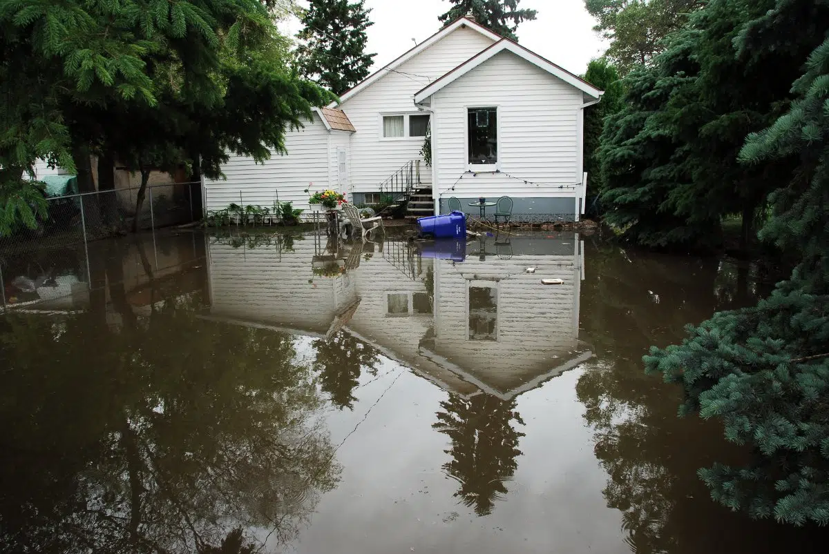
The Water Security Agency has just released its April forecast and update on the spring runoff and many areas in and around Prince Albert are seeing red.

This means those places are now at a “very high” risk of runoff and flooding, which is a change from the March forecast.

“It is an area that’s larger than a month ago and that is due to the higher volume of snow we received in March,” said Ken Cheveldayoff, minister responsible for Saskatchewan Water Security Agency (WSA).

In order for this forecast to become a scary reality, Cheveldayoff said we need temperatures to get warm quickly.

“We need some constant temperatures [with] highs in the plus 10 degrees and lows in the minus 5 area, so that range is what we’re looking at and we haven’t seen any of that yet and we know it’s coming, but we’re hoping that we’ll be able to see it and enable a slower runoff,” he said.

Much of the province is at least in the “above normal” runoff or worse including Moose Jaw to Indian Head then south to Weyburn, and from Saskatoon to North Battleford extending north through Prince Albert and Spiritwood to Waskesiu Lake.

“It’s a top concern for the government of Saskatchewan … we’re making sure we’re communicating with communities across the province,” Cheveldayoff said.

To help deal with the potential flooding the WSA launched the 2013 Emergency Flood Damage Reduction Program (EFDRP) last week and Cheveldayoff said they have already received 44 applications.

This program gives assistance to implement emergency flood damage reduction or prevention measures and he suggested taking a look at where flooding occurred in 2011 to get an idea of where it may strike again.

The WSA is also providing a mobile website (www.wsask.ca) where users can browse the most up-to-date news and advisories, as well as search communities to view a chart of the stream flows and lake levels nearest them.

What you can do

In addition to the WSA’s advice, customer service manager at Anderson Pump House Tim O’Shaughnessy suggests a few other precautions.

“With the rural areas it can come up overnight like as soon as the ground thaws, and depending on how deep the frost got in your local area, it can happen quite quickly,” O’Shaughnessy said, adding this is where the biggest flood threats come from.

“We’ve seen water tables in the north area of PA change between six and eight feet over the past two years, up and down.”

Any lower lying homes have significant risk of flooding from underneath the foundation, which is why he said homeowners need a sump pit and sump pump to discharge it out to lower-lying areas. He added it would be a good investment for homeowners to purchase small water alarms that will alert you when water gets into the basement.

The colder temperatures of late are prolonging the snow thaw, so O’Shaughnessy said they haven’t been too busy but he expects that all to change in the coming weeks.

“We’re still anticipating a major rush. Once the ground thaws is when we’re really going to see what the level of snow is going to do … there’s a lot of moisture to come yet.”

sstone@panow.com

On Twitter: @sarahstone84