Click here to sign up for our free daily newsletter.
A sign of the times near Meath Park between Prince Albert and Nipawin. (Image Credit: Facebook/Ron Knutson)
Spring runoff 2026

Evacuations begin as flooding continues, 19 active floods recorded

May 5, 2026 | 12:40 PM

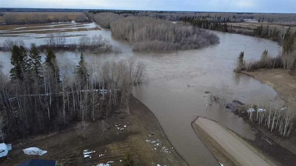
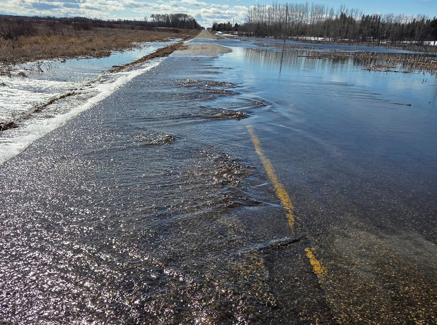
The north central belt of Saskatchewan continues to battle high water brought on by high levels of snowmelt with multiple RMs running out of materials like barricades and sandbagging equipment.  

First Nations Evacuated

Record flooding along the Shell and Carrot rivers has forced evacuations from First Nations communities in northern Saskatchewan and prompted the Prince Albert Grand Council (PAGC) to activate its Emergency Operations Centre (EOC).

Members of Red Earth Cree Nation and Shoal Lake Cree Nation were evacuated late Monday, with Priority 1 individuals — those requiring immediate medical or vulnerability support — along with Elders, prenatal and postnatal members, and high-risk members moved from both communities as of Tuesday.

PAGC activated its EOC Tuesday with representatives from Saskatchewan First Nations Emergency Management and the Saskatchewan Public Safety Agency to coordinate support and monitor rapidly changing conditions. Officials said they are also working closely with the Canadian Red Cross to prepare for the emergency and support evacuated members as they register for assistance.

Grand Chief Brian Hardlotte said PAGC is tracking flooding from both river systems while keeping communication open between First Nations leadership, emergency partners and government agencies.

“Water has its own way of returning to the land. That is nature’s way,” he said. “But when it comes back like this, it creates serious problems for our communities, our roads, our homes and our families. Our priority right now is safety, communication and making sure our First Nations have the support they need.”

According to the Water Security Agency, the Carrot River near Smoky Burn has broken all records at the station. Flows on Monday exceeded the gauge’s measurement capacity and briefly forced it offline. A measurement taken Monday recorded 900 cubic metres per second, with flows climbing to about 980 m³/s by Tuesday morning — the highest the Water Security Agency has recorded on the river.

Water levels are now 2.9 metres higher than they were on April 29. Officials say the updated peak-flow estimate is 1,050 cubic metres per second, which would amount to a one-in-100-year event. The previous record at the station was 816 cubic metres per second, set in 1972. Monitoring continues, and the peak may not arrive until around May 9.

Vice-Chief Christopher Jobb said the EOC is focused on communication, co-ordination and public safety as communities prepare for several more days of high water.

“We are doing our best and opening lines of communication with our communities and emergency partners,” said Vice Chief Jobb. “We are asking everyone to be safe out there. Please listen to your local leadership, avoid flooded areas and give emergency crews the room they need to do their work.”

Sturgeon Lake First Nation is also responding to rising water. PAGC Vice-Chief Joseph Tsannie is meeting with Sturgeon Lake leadership to assess local impacts and emergency response needs.

Prince Albert and area

By 11 a.m. on Tuesday the Saskatchewan Public Safety Agency (SPSA) had 19 active floods on its website, more than double the nine listed last year at the same time.  

Late on Monday evening, the RM of Buckland said the White Star Road has been washed out at Shell River Heights and the water was still rising rapidly.  


White Star Road north of Prince Albert/Scott Tyler Bird

Residents were warned to prepare for evacuation.  

Likewise, the neighbouring RM of Paddockwood said they have applied for designation under the provincial disaster assistance program and reminded residents to keep track of their flood-related expenses.  

A main road covered by water, showing signs of washout.
A main road covered by water, showing signs of washout. (Image Credit: Facebook/John B. MacDonald)

Road repairs will begin with people who are blocked in with no road access out, then continue on to main roads and high traffic routes.  

Due to accessing provincial disaster funding, full repairs on some side roads could take extra time.  

Work can’t start until the water subsides, which could still be several days away.  

The RM of Garden River is also out barricades and flagging material due to extreme flooding.  

All drivers were warned again that driving through water is not advisable since the ground underneath can be compromised by runoff.  

The Lakeland and District Fire Department responded yesterday to rising flood waters in the Village of Christopher Lake. Water was flooding roads, properties and threatening homes.  

Crews hauled about 30 loads of water away with two tanker trucks. The village advised that Central Avenue north was flood and not safe for travel on May 1.  

Nearby in Candle Lake, village staff, firefighters, several local businesses and residents all pitched in to pump water, move equipment and set up hoses to reduce the risk of flooding to properties.  


The Torch River on May 3. Facebook/Gary Simon Outfitting

In the RM of Torch River, water levels continued to rise on Monday in the Joint Venture Area, a shared emergency response zone that includes the Town of Choiceland and Villages of Love, White Fox and Smeaton.  

In the RM of Shellbrook, staff warned people Tuesday morning that the Sturgeon and Shell Rivers continue to rise and some culverts are close to capacity. 

People living in low lying areas should monitor the situation closely and be prepared to leave if necessary.  

Some roads in the RM are covered with water, blocking passage. The RM has declared a state of emergency.  

North Battleford, Meadow Lake & Area

Water levels in the RM of Meadow Lake are slowly decreasing. 

Over the weekend, crews assessed two bridges in the area. One was replaced with a temporary bridge, and gravel was added to the other to help with water flow. 

On May 1, a fire ban was set in place for the RM to ensure emergency resources can focus on monitoring water levels instead of fighting fires. They will continue to monitor high risk areas as the flooding improves. 

North Battleford’s Fire Chief and Operations Director say they have no concerns regarding high water levels.  

They expect water flows will be faster than normal this spring because of the quick melt and water levels may be higher, but neither are of significant concern.  

La Ronge & Area

As of 8 p.m. on Monday, Highway 918 in Northern Saskatchewan remains closed. It is the only road in and out of the English River First Nation (ERFN) community of Patuanak, which has a population of approximately 500.

The Ministry of Highways has been busy installing culverts and has started stockpiling gravel for road work. According to the ERFN Management Team, water appears to be subsiding.

Flooding is also occurring on Highways 165 and 910. Highway 165 near Beauval is completely closed, while the Highway Hotline shows Highway 910, the only access road to Pinehouse Lake, as open as of 1 p.m. on Tuesday.

panews@pattisonmedia.com with files from Susan McNeil, Nigel Maxwell, Alyssa Rudolph and Derek Cornet