Click here to sign up for our free daily newsletter.
“A strong low pressure system will bring heavy snowfall to the region today,” Environment Canada said. “Snow will continue through this morning and be particularly heavy through the day, ending Thursday evening.” (Image Credit: CKOM)
Spring Storm

Wind and snowfall warnings in effect for Saskatchewan as late-season storm moves into province

Apr 23, 2026 | 9:57 AM

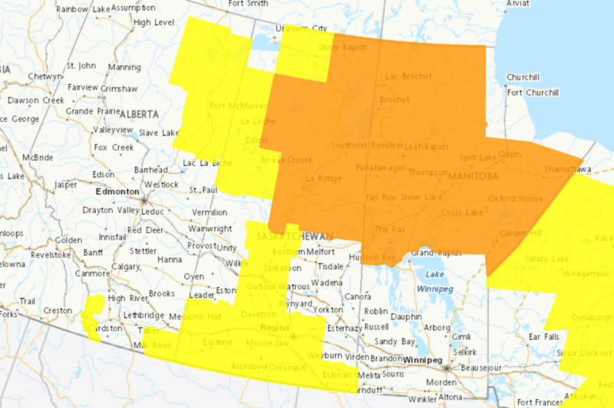
Wind and snowfall warnings from Environment Canada blanketed much of Saskatchewan on Thursday morning as a spring snowstorm makes its way into the province.

Areas around Saskatoon, Prince Albert, Davidson, Outlook and Rosthern were included in the snowfall warning area, with Environment Canada saying 15-20 centimetres of snow is expected by the end of the day.

“A strong low pressure system will bring heavy snowfall to the region today,” the weather service said in a statement.

“Snow will continue through this morning and be particularly heavy through the day, ending Thursday evening.”

Meanwhile, a large area of southern Saskatchewan, including Regina, Moose Jaw, Swift Current, Weyburn and Estevan, was covered by a wind warning, with Environment Canada saying gusts of up to 100 km/h are expected throughout the day on Thursday. The high winds could cause some power outages or other issues with local utilities, the weather service noted.

Wind and snowfall warnings from Environment Canada covered most of Saskatchewan on Thursday as a storm makes its way into the province.
Wind and snowfall warnings from Environment Canada covered most of Saskatchewan on Thursday as a storm makes its way into the province. (Image Credit: Environment Canada)

Environment Canada meteorologist Keane Kokolsky said the strong wind gusts are expected to roll into the Regina area around noon on Thursday.

“If you’re traveling on a Trans-Canada Highway, it’s going to make for a windy ride, unfortunately,” Kodolsky said.

“Those winds will more or less continue into the weekend, but not as strong. They will just be gusty at times. But today we’ll definitely see the strongest winds from the system.”

Kokolsky said residents of southern Saskatchewan might want to secure any objects in their yards that could be blown around by the high winds.

In the northern areas of the province, even more snow is expected. Areas north of Nipawin, including La Ronge, Stanley Mission and Montreal Lake, could see between a foot and 50 cm of snow over the next two days, Environment Canada said.

“Total snow amounts of 30 to 50 cm are expected by the end of the day Friday, with the heaviest snow expected to fall today. Freezing rain or ice pellets may also cause slippery conditions in some areas, including Cumberland House and parts of Highway 123,” Environment Canada said.

“Snow will begin tapering off Friday night, but light snow will continue into the weekend.”

Communities north of Meadow Lake will also get a significant amount of snow as the storm moves in, Environment Canada said, with 20-30 cm expected to fall by the end of the day on Friday.

Kokolsky said the roads could get hazardous, depending on how much snow accumulates on the ground. The Saskatchewan Highway Hotline was advising against travel on routes in the Gravelbourg area, southwest of Moose Jaw, on Thursday morning, along with a number of routes in northern Saskatchewan.

“I just advise people to be careful on the roads if they are traveling,” he said.

He said the snowfall warnings could be expanded later on Thursday.

“We’re pretty confident with where we have it right now, but definitely the surrounding areas – like Humboldt, Nipawin and Melfort areas – there’s definitley the possibility for some accumulating snow there, but not as much as where we have the snowfall warning,” Kokolsky said.

The latest updates on the weather alerts can be found on Environment Canada’s website, and current information on road conditions can be viewed on the Saskatchewan Highway Hotline.