Heavy snowfall warning brings winter back to Saskatchewan
-
Share on Facebook
-
Share on Bluesky
-
Share on X
- Copy Link
The forecast confidence is ‘high’ and so is the impact level, as parts of Saskatchewan brace for a huge dump of snow.
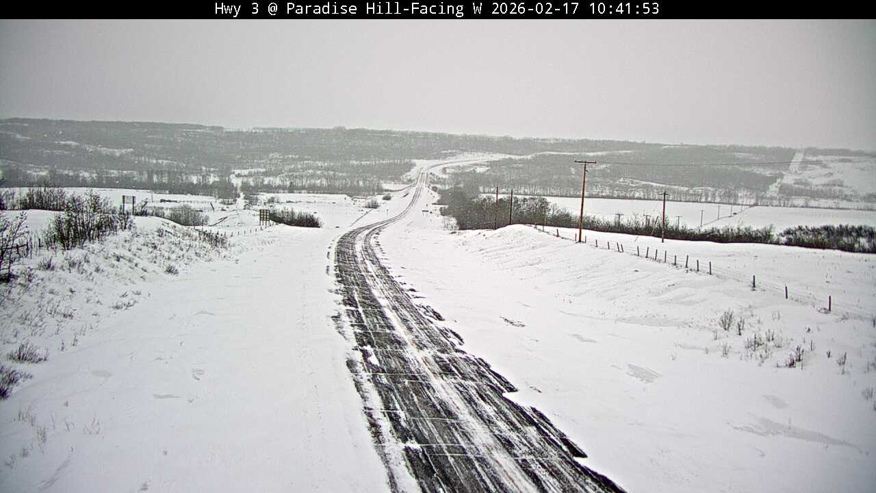
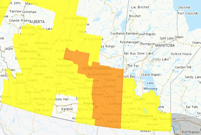
Environment Canada issued a severe snowfall warning for Meadow Lake southeastward to Estevan. Danielle Desjardins, a warning preparedness meteorologist with Environment and Climate Change Canada, said a low pressure system that’s developed over Montana is expected to bring total snowfall amounts up to 35 cm in some areas, especially Meadow Lake and Prince Albert.
“It’s bringing in a lot of moisture in from the southwest. These systems typically, they’ve got a lot of energy to work with all the moisture,” Desjardins said. “We could see upwards of 35 cm once this is said and done and the first wave is already ongoing. We have gotten reports of at least 6 cm in Meadow Lake and about 5 cm in Cold Lake [near Pierceland] and that’s just the beginning with this first wave that we are expecting to persist today, tonight and into tomorrow.”
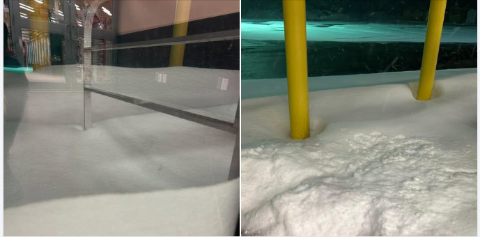
Around 7:30 a.m., the Meadow Lake Home Hardware Building Centre posted on its social media page that the blowing snow had already accumulated at the front door. The store also posted that it had lots of snow clearing equipment in stock. (Image Credit: Meadow Lake Home Hardware Building Centre/Facebook)