Subscribe to our daily newsletter
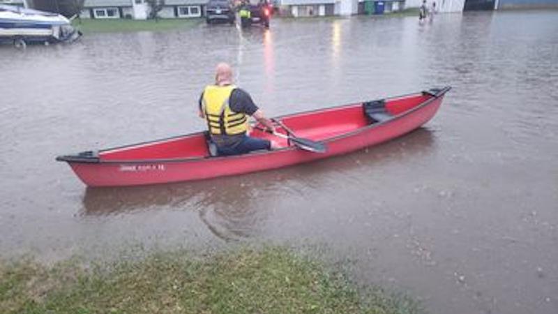
A man is seen in a Canoe around Macintosh Drive following a flash storm in Prince Albert on Thursday. (Submitted Photo/Michael Lalonde)
FLASH FLOODS

P.A. sees flash flooding Thursday as more storms forecasted this weekend

Jun 2, 2023 | 10:39 AM

More rain and thundershowers are expected this weekend after a flash storm tore through Prince Albert and surrounding areas Thursday night.

It didn’t take long after Thunderstorm Advisories were first issued that the clouds opened, brining plenty of rain to the area.

Some parts of the city experienced flashed flooding including sections of the Cornerstone parking lot and 15 Street East.

Some businesses also felt the effects of mother nature. Employees at Smitty’s in South Hill were reportedly seen shovelling water from inside the restaurant. Many leaks were also attended to at Plaza88.

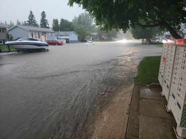
(Derek Craddock/paNOW Staff)

Residents of Macintosh Drive in Prince Albert were among several neighbourhoods that saw their streets become rivers.

(Submitted Video/Michael Lalonde)
(Submitted Photo/Michael Lalonde)

While the storm cleared later in the evening and roads eventually returned to normal, there’s a chance that stormy activity could return this weekend.

As of Friday morning, the forecast for the Prince Albert area is calling for showers and the possibility of thundershowers later in the evening. There’s a possibility of rain falling on Saturday with clear skies coming for Sunday and Monday.

Jim Price is a Meteorologist with Environment Canada and said they are tracking a storm system moving through parts of the province soon.

“It’s going to be moving through today and into Saturday and then we’ll be going over northern Saskatchewan into Sunday,” he said.

As for rainfall, Prime said it’s hard to gaugue that right now as it depends on where the thunderstorms eventually land. However, he anticipates some regions could see between 10-20 millimetres.

According to the Environment Canada station at the Prince Albert airport, roughly 18 millimetres fell Thursday.

“There’s a really humid air mass and we kind of have all those ingredients that could come together to create those thunderstorms and some heavy downpours,” said Prime. “But it really just will depend on where that forms and where those storms drift.”

It wasn’t just P.A. that was affected as storms also ripped through Regina and parts of southern Saskatchewan Thursday afternoon.

Environment Canada said a band of thunderstorms hit a broad area of the province at that time, producing strong winds, lightning, intense rain and large hail.

Meteorologist Shannon Moodie said the hardest-hit areas were Assiniboia, Moose Jaw and Regina.

“We had quarter-sized hail early in the day in Assiniboia and then reports of golf ball-sized hail,” Moodie said. “In Regina, there’s been several reports of flooding online and the airport reported 22 millimetres of rain overnight.”

Streets in the Queen City were covered in water early Friday causing numerous road closures. The water was so deep in places that photos online showed stranded vehicles in underpasses and floating waste container bins.

Earlier in the day, some regions of the north west and west-central were hit with funnel cloud advisories but so far there’s been no reports of tornadoes touching down on Thursday.

-With files from 980 CJME

panews@pattisonmedia.com

Twitter: @princealbertnow

View Comments