Click here to sign up for our free daily newsletter.
The RM of Fish Creek advised drivers to avoid River Road as it has washed out. (Image Credit: Facebook/RM of Fisher Creek)
Spring in Saskatchewan

Sask Public Safety Agency responds to localized flooding throughout province

Apr 23, 2026 | 4:26 PM

A string of snowstorms this winter maintained a line across the middle of Saskatchewan, starting near Meadow Lake and Lloydminster and running along Highway 16 heading east toward Yorkton.

“The snowpack has just continued to build and build and build and that tells you where that jet stream was, because the jet stream is the path which all these low-pressure systems generally follow,” explained meteorologist Terri Lang with Environment Canada.  

“It’s been sitting right over the middle of the province, so the poor southwest hasn’t been getting anything.” 

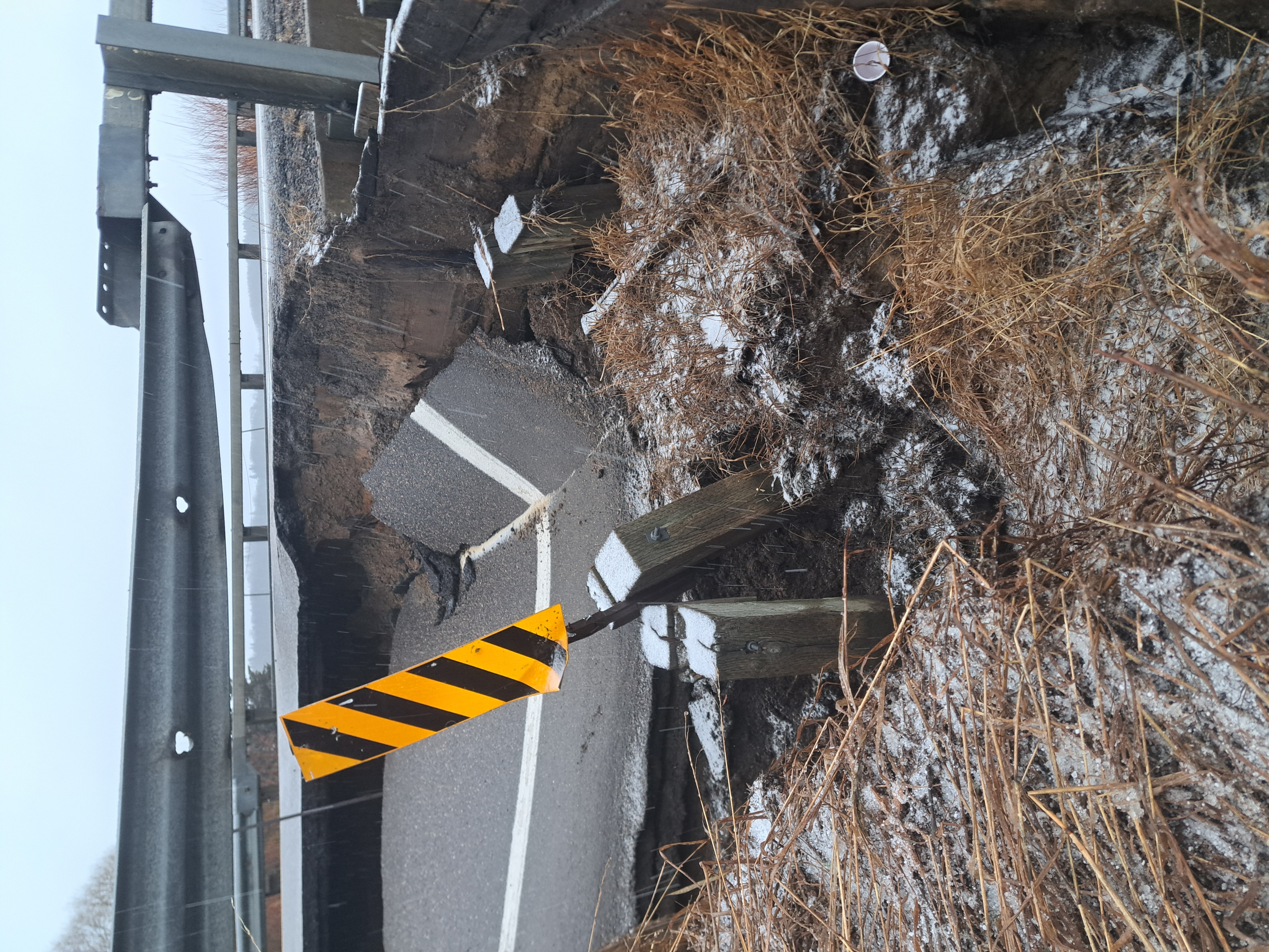
Many areas in Central Saskatchewan are now experiencing localized flooding, leading the Saskatchewan Public Safety Agency (SPSA) to issue an high water advisory alert last week and hold a media briefing Thursday afternoon.

Further west, Meadow Lake has declared a state of emergency and the SPSA is staying in contact with Foam Lake and Pierceland, south of Melfort, and the RM of St. Louis, south of Prince Albert.  

“So several communities have experienced localized overland flooding and ice jamming because of this,” said Shawn Jaques of the Water Security Agency (WSA).

The high flow advisory extends from Buffalo Narrows to Yorkton.  

Northern Saskatchewan has not been spared, and a high flow advisory is in effect for Buffalo Narrows and La Ronge. At the same time, the northwest is expecting up to 50 cms of snow on Thursday and Friday.  

Foam Lake, Watrous, Melfort, Nipawin and Tisdale are also seeing localized flooding and remain in contact with the SPSA but do not need extra help.  

Both the Town of Foam Lake and the RM of St. Louis have declared local states of emergency. 

Beardy’s & Okemasis Cree Nation, west of Prince Albert, was supplied with a sand bagger and some bags Wednesday morning. 

The Village of Pierceland has some ground water flooding at its lift station.  

The RM of Fish Creek, near Wakaw, had a road wash out leading to a large chasm in the middle.  

“What’s really occurred this year is, you know, we’ve seen an above normal snowpack in the northern part of our province, and it was a cold, cooler, wet spring with slow melting, which allowed for kind of perfect conditions,” Jacques said.  

The fast warm up – as in 15 C on Tuesday – made for a very fast melt, but the worst seems to be over. 

“With the exception of a few isolated areas, we anticipate we’ve experienced peak flows in most systems impacting the communities. There are still some areas of concern in the northern end of the Saskatchewan River Basin and, you know, in that northwest part of our province,” Jacques said.  

According to the SPSA, the new snow that is coming will not create flooding where runoff has already peaked and is going down.  

Rural municipalities can experience issues with run off affecting gravel roads as the surface handles the water differently.  

“On paved roads, it depends on the flow and how quick the flow is and how concentrated it is. Paved roads will probably be a little bit more forgiving and could take a little bit more, but and gravel roads, as soon as you start getting a channel, then the flow becomes concentrated into one smaller area and then you will get quicker flow and that’ll speed up things quicker.”

A section of Highway 304 southwest of Meadow Lake has been closed after a bridge was damaged by spring runoff and high water.
A section of Highway 304 southwest of Meadow Lake has been closed after a bridge was damaged by spring runoff and high water. (Image Credit: Ministry of Highways)

Meanwhile, Lang said the weather patterns are creating the perfect recipe for heavy snow.

“In the spring we have access to some warmer air that’s trying to come up from the south and warm air can hold more moisture,” she explained. “More moisture can hold more snow or create more snow.”  

Adding the warm air from the south to the cold air to the north and the snow event happening in the north.

“Beauval and La Ronge are really getting hammered right now,” Lang said.  

La Ronge has a winter storm warning in effect. Total snow amounts of 30 to 50 cm are expected by the end of the day Friday.

susan.mcneil@pattisonmedia.com