Subscribe to our daily newsletter
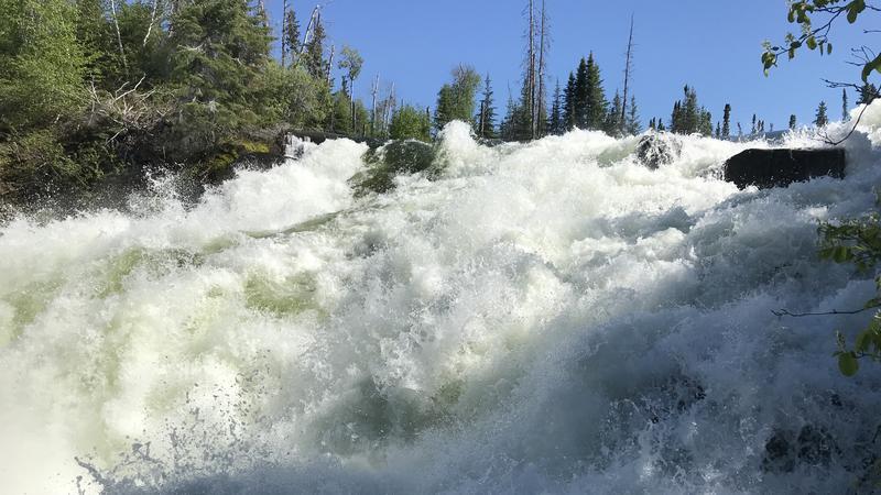
Nistowiak Falls is where Lac La Ronge meets the Churchill River. (Derek Cornet/larongeNOW Staff)
High River and Lake levels

Northern Saskatchewan sees record-high river and lake levels

Jul 24, 2020 | 12:25 PM

With all the rain that’s fallen in northern Saskatchewan since the start of April, some lakes and rivers are seeing historical highs in river and lake levels.

The Lower Churchill River, including Reindeer River and Churchill River near Sandy Bay, have already exceeded previous records.

Other areas have peaked or are projected to peak at near-record highs.

Saskatchewan’s Water Security Agency is expecting high river and lake levels to remain for the remainder of the summer.

Ile a la Crosse:
Present elevation: 421.06 m (potentially elevated by wind setup)
Estimated peak: 421.1 m on or near July 28, 2020

Sandy Bay:
Present Elevation: 9.93 m (2320 m3/s)
Forecasted peak: 10.23 m (2440 m3/s) on or near August 15

Lac La Ronge:
La Ronge current elevation: 364.81 m
Projected peak: 364.87 m on or near August 14

Sandy Bay:
Present Elevation: 9.93 m (2320 m3/s)
Forecasted peak: 10.23 m (2440 m3/s) on or near August 15

Meeting Lake

· Meeting Lake has received approximately 275-300 mm of precipitation since April 1 (~150 per cent normal)

· July 22 lake level is 739.48 m

· Outlet spill elevation is 739.23 m (25 cm lower than current lake level)

· Meeting Lake has reached its outlet and is confirmed flowing into outlet channel

· There is not significant flow moving through outlet currently as it is congested with thick vegetation.

· Berms around the lake should now be built to WSA recommended standard (739.83-740 m)

· Local contractor is putting finishing touches on last berms currently (riprap, granular tops)

Cumberland House:
Present Elevation: 267.75 as of 8:00 AM July 24
Forecasted peak: Peak observed on July 23

Future Rainfall Light rain over the Reindeer Lake area is expected today as the system that had been impacting northern Saskatchewan makes its way into Manitoba. Additional rainfall is expected over the weekend with central areas of the Churchill Basin expected to receive the highest accumulations with general accumulations of 10-20 mm expected and localized higher amounts within thunderstorms.

panews@jpbg.ca

On Twitter: @princealbertnow

View Comments