Subscribe to our daily newsletter
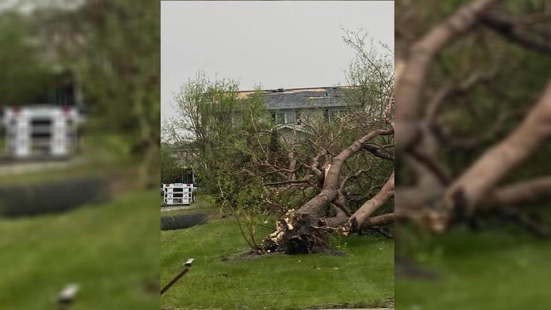
It could have been a tornado or a plough wind that caused extensive damage in the Brancepeth area. (submitted photo/Larry Markowski)
Wild Weather

Mystery remains whether tornado or plough-wind caused Brancepeth damage

Jun 15, 2020 | 11:37 AM

The same storm system that brought pounding hail and flooding to Calgary on Saturday is responsible for damage across Saskatchewan this weekend.

Significant power outages were reported in the Elrose area after a wind event late Saturday night, and another lengthy outage hit the Prince Albert area Sunday afternoon when damaging winds hit the Hamlet of Brancepeth. Also on Sunday, train cars were knocked off the track, trees were uprooted, and farm equipment was tossed around.

Terri Lang, meteorologist with Environment Canada, doesn’t know for certain what the wind event was in Brancepeth, and is encouraging people in the area to submit their evidence for evaluation.

“It’s very hard to tell, because these plough winds, that we call straight-line winds, they can have the strength of an EF2 tornado so it’s really hard to see the damage pattern, how far it went, what it looks like, that type of thing,” Lang said.

“If [local residents] have any photos of damage, picture, videos, especially of the clouds or anything like that to send them in, post them with #skstorm on twitter, or send them to Environment Canada via our email which is sk.storm@canada.ca.”

While this broad low pressure system created extreme weather events in certain areas including Humboldt, where a reported three to four inches of rain fell in just over an hour, Lang said this is nothing out of the norm.

“Very typical for this time of year, we’re right in the heart of severe weather season,” Lang said.

The storm system has now cleared out of Saskatchewan and will settle over Manitoba today, however that doesn’t mean sunny days are ahead in the region. Environment Canada is calling for rain right through the work week across the north central region.

“It looks like what we call a really unsettled week. We have these weak low pressure systems floating around, so expect on and off showers and thunderstorms,” Lang said. She added severe storms are not expected although thundershowers can create some hit and miss rainfall.

“People should be prepared for showers, thundershowers, and possibly some heavier rains. We’re not talking flooding, but we’re talking enough rain that people should be taking note of it and not planning picnics and that type of thing,” Lang said.

In May, Prince Albert recorded 88 mm of accumulated precipitation, which is double the historical average of 44. Halfway through June, there has now been 59.7 mm compared to the monthly average of 68.6.

trevor.redden@jpbg.ca

On Twitter: @Trevor_Redden

View Comments