Click here to sign up for our daily newsletter
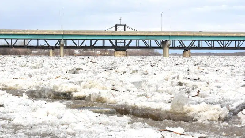
The North Saskatchewan River broke on Sunday morning. (Jeff D'Andrea/paNOW Staff)
North Saskatchewan River

P.A. police ask public to keep ‘safe distance’ from high flowing North Saskatchewan River

Apr 26, 2020 | 10:36 AM

On early Sunday morning, the North Saskatchewan River started to roar as it had its annual spring ice break up.

This has led to flooding along the riverbank, at Little Red River park and areas along the Rotary Trail, due to higher than normal water levels. According to the City of Prince Albert, the river rose to as high as 6.584 metres, and at a speed of 2870 cubic metres per second.

“We have been actively monitoring the river and it appears it has peaked and levels are steadily declining,” Wes Hicks, director of public works for the City of Prince Albert, said in a statement. “There has been damage to sections of the rotary trail but the extent at this stage is unknown and will be assessed in the coming days.”

The height of the river is so high, parts of the Rotary Trail that run along the river are completely washed out with water, ice, and slush. There are also large chunks of ice, logs among other things flowing at a large rate of speed.

At one point, it even took off part of a handrail on the trail, near Central Ave.

“The River is extremely high and flowing with hazardous ice and debris. We want to express the safety concern that this poses to our citizens and to please keep a safe distance from the river water flow,” Staff Sergeant Dave Schluff of the Prince Albert Police Service said in a statement on Sunday morning.

Back on April 20, the Water Security Agency cautioned that the North Saskatchewan River could have ice jams, which could cause flooding from the Alberta border, down to the confluence with the South Saskatchewan River downstream of Prince Albert.

“The lateness of snowmelt runoff is increasing the risk of a rapid warmup and melt, resulting in the potential for higher runoff than anticipated,” the statement read. “Some localized flooding and ice jamming on smaller streams and rivers could occur, with areas of highest risk is in the central part of the province from Highway 16 up to the Churchill River, where late winter snowfall was significant and minimal snowmelt has occurred to date.”

Jeff.dandrea@jpbg.ca

On Twitter: @jeff_paNOW

View Comments