Sign up for our free daily newsletter
(File photo/Government of Saskatchewan) 
flood prevention

P.A. to get federal dollars for detailed flood mapping

Aug 12, 2019 | 4:56 PM

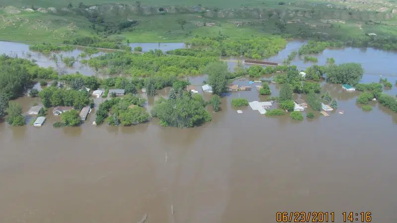
Prince Albert is getting some of the million dollars from the federal and provincial governments for flood mapping in Saskatchewan to help with future planning. Meanwhile, a city councillor who represents residents in the flood plain, hopes the latest mapping data will show a reduction in the threat.

The Water Security Agency (WSA) says LiDAR – a sophisticated laser 3D survey of the North Saskatchewan River – is being used to predict exactly where future flood defences may be needed.

“That [technology] allows us to get a fairly accurate idea of where water will flow and what areas may be prone to, or on the fringe of flooding,” Sam Ferris with the regulatory division told paNOW. “There may have been work done in previous years but things change. Drainage ditches are constructed, a variety of areas can be built up with infill of soils, so this will bring materials up to date so to speak.”

Prince Albert has four different neighborhoods and over 2000 properties lie within the 1-in-500 year floodplain, according to the WSA. It said this new data would more accurately reflect the risk of future flood events and allow for mitigation efforts. Ferris said the money spent now on preparation was well worth it.

“For every dollar invested in flood prevention and mitigation, such as flood mapping and modelling, if you didn’t do that it would be 20 to 30 times more expensive to address that after the emergency,” he said.

The city of P.A. is matching the $60,000 coming from Ottawa for the $120,000 local project.

Ward 4 councillor for P.A. Don Cody lives in the area most at risk for flooding. He welcomed the money for the special high tech mapping noting it was far better to invest in mitigation than face costs after the fact.

“It’ll tell us exactly what we need to do to mitigate any potential flooding,” he said.

Cody is also hopeful the LiDAR mapping will show the area is not at such a risk as previously thought.

“Right now our mapping is so outdated, I’d be surprised if the properties they say are in the flood zone are there after this mapping is done,” he said. “Rivers change over the years. They move differently, the soil under the river changes.”

“I think we’re going to find when this is said and done that we won’t have nearly the amount of people and property involved here that we have today,” Cody said. “Possibly what we can do at some time is do a bit of dyking at the ends of the [flood] area and that may mean we will hardly have any properties [at risk.]”

The LiDAR mapping project started in May and runs for a year.

glenn.hicks@jpbg.ca

On Twitter:@princelabertnow

View Comments