Subscribe to our daily newsletter

Massive map educates students on Canadian Boreal Forest

May 7, 2014 | 5:09 PM

It’s a really, really big map, and its travelling across Canada in an effort to educate both children and adults on our boreal forests.

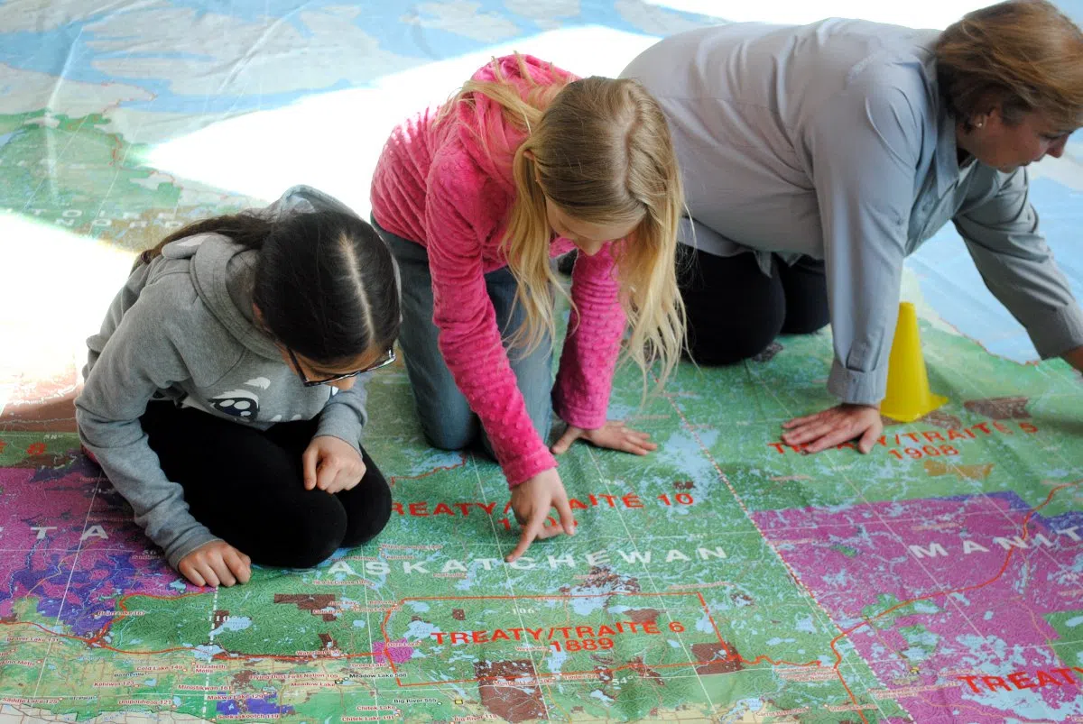
As part of the ‘On The Move’ campaign the Canadian Boreal Forest Agreement (CBFA) in partnership with the Royal Canadian Geographical Society (RCGS), has created a 8 x 11-metre map showing the forest and caribou populations across Canada.

“The giant map is an educational tool to help illustrate the scale and significance of the Boreal Forest and the Canadian Boreal Forest Agreement,” said Aran O’Carroll, CBFA executive director. “The folks at the Royal Canadian Geographical Society who publish Canadian Geographic Magazine came to us with this great idea of ‘let’s get out and tell the story of the Boreal Forest.’”

He added the agreement initiative is put together to find ways to keep forestry hotspots like Hudson Bay sustainably running while protecting wildlife.

“We have to try to find solutions for the largest terrestrial ecosystem in Canada, all the way from British Columbia out to Newfoundland,” said O’Carroll. “We’re working on solutions for woodland Caribou conservation, but we’re going to do it in a way that’s going to ensure the sustainability of the wood supply.”

Students from Red Wing Community School visited the Forest Centre in Prince Albert to experience the big map by walking on it and visiting various parts of Canada and the boreal forest.

“We learned about the Boreal Forest and how large it was, and we learned about how important it was to take care of it and preserve the animals,” said 11-year-old Kelly Lam. “You can actually show the example of how big it is and all the cities and the provinces and territories.”

Joey Skotheim was really interested in learning about the Caribou.

“I learned about Caribou and that they’re getting extinct,” said Skothiem.

Sara Black, education programs co-ordinator for the Royal Canadian Geographical Society, was on hand to help the kids explore the map.

“I love this tool because there is a strong focus on the use of technology,” said Black. “This allows students to not only take off their shoes, but to put down their electronic devices and to tell their own stories.”

She added that it gives all students the opportunity to become the teachers as well.

“You find students who are the quiet ones sitting at the back of the classroom and they’re the leaders in the classroom, they’re the engagers,” said Black. “They’re sharing where they went on a family vacation, they’re sharing what they know. They’re the teachers on the map.”

“It gives students the opportunity to be leaders and to be teachers.”

The map is still on the move as well, the next stop is White Horse, YT.

“We’re going to be meeting with scientists who are working on Caribou conservation from all across Canada,” said O’Carroll. “We’ll have the scientists in their stocking feet running around on the map.”

The organizations visited both Carlton Comprehensive High School and St. Mary in Prince Albert with the map as well. 

The map has also been featured in Ottawa, Edmonton and Peterborough, Ont. 

jbowler@panow.com

On Twitter: @journalistjim